

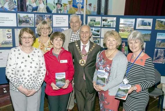
THE latest edition of a booklet that has helped keep footpaths on both sides of the Wye in good condition has been launched.
Since it was first published in 2004, the Lower Wye Ramblers’ booklet of walks in the Forest and Wye Valley has raised more than £10,000.
The fifth edition of Lower Wye Rambles was launched at an event at the Drill Hall in Chepstow.
The booklet contains 16 walks suggested by members of the Lower Wye Ramblers between Chepstow and Monmouth.



Chair of the group Jackie Colclough paid tribute to footpaths officer Alan Thomas and membership secretary Bill Price as the “architects” of the booklet.
Ms Colclough said: “The booklet has without doubt contributed to the popularity of the Lower Wye Valley as a great walking area and in turn has promoted tourism and the businesses that depend on it.”
The first booklet was the brainchild of Alan Thomas as a way of marking the group’s 10th anniversary in 2004.
Ms Colclough added: “Despite the low price, income accumulated rapidly
“It was agreed that as the money had been derived from walkers, the profits should be used to maintain and improve footpath access.
“Since then more than £10,000 has been provided for that purpose.
“Over the years donations have been made to Monmouthshire County Council, Gloucestershire County Council, Gwent Wildlife Trust, Gloucestershire Wildlife Trust and the Heart of Wales train line association
“These donations have helped to fund path improvements and the installation of path furniture including bridges, gates, stiles, culverts, finger posts, steps and waymark posts – some of which were installed by Lower Wye members who formed a working group to maintain the paths in the booklet.
“As a result paths that were previously overgrown and neglected were opened up and made available to the public.”
“Although as a group we do walk many routes further afield, we do regard the area between Chepstow and Monmouth as our patch and consider ourselves proud and lucky to have it on our doorstep.
“We each have our favourite walks, but when I was asked to choose a couple for publicity, I was spoilt for choice having spent many enjoyable days walking them.”
The new edition of the booklet sees hand-drawn routes replaced with Ordnance Survey map extracts and each walk now has a schematic diagram showing ascents and descents and helpful gradings that indicate the level of difficulty of the walk.
Comments
This article has no comments yet. Be the first to leave a comment.