
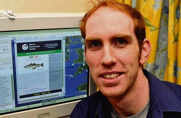
LYDNEY man Ryan Townley and a team of scientists at the Marine Conservation Society in Ross-on-Wye have given Google Ocean map users a picture of the earth's fishery resources.




"The aim was to create a feature map layer showing where in the world some of the most sustainably-sourced kinds of fish come from," said Ryan, who has been working for the society for three years.
While he programmed details of most of the 43 individual food species into the maps for Google he insists the work was a team effort.
The society's communications manager, Richard Harrington, told the Review the 29 staff at the Ross HQ were very pleased with the result.
"Our first Google Map layer shows the fish available to consumers that can be obtained without risk of depleting stocks – a positive message to accompany the launch of Ocean on Google Earth," he said.
Free downloads of Google Earth are available and visitors need to navigate to the Oceans site then follow links to the 'State of the Ocean' folder. This contains the MCS Fish to Eat layer.