A red weather warning for extreme heat remains in force until 11.59pm tonight, and it’s immediately going to be replaced by another warning. But this time it’s for something a little different. Here comes the thunder!


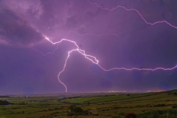
From midnight until 10am there will be a yellow weather warning in force for thunderstorms, as the Met Office says it could bring more disruption to some.
- There is a slight chance that power cuts could occur and other services to some homes and businesses could be lost.
- Where lightning strikes or flooding occurs, there is a chance of delays and some cancellations to train and bus services.
- There is a small chance that homes and businesses could be flooded quickly, with damage to some buildings from floodwater, lightning strikes, hail or strong winds.
- Spray and sudden flooding could lead to difficult driving conditions and some road closures.
The forecaster has said many areas will miss the thunder, but where the storms do happen they may produce sudden, gusty winds with 50 to 60 mph possible, particularly in the south and west of the warning area. Frequent lightning, hail and heavy rain (possibly 15-20 mm in an hour) are additional hazards.
For those struggling with the higher temperatures, there appears to be no relief from the high temperatures on the horizon. Wednesday night saw the warmest June night Wales has ever recorded, with the lowest temperature at 23.5 degrees celsius and temperatures are tipped to be similar tonight.
Temperatures are expected to cool slightly after the brief thunderstorm passed through, and conditions should be dry for the weekend as temperatures still climb into the late 20s.
Comments
This article has no comments yet. Be the first to leave a comment.