
Its three volumes of 550 pages and 55 maps (at £20 each volume) doesn't look a scintillating read. Yet the district council's plan for the next ten years provides an eagle's-eye view of the Forest down to the last square yard.
The two maps showing the North and South Forest (the dividing line running from May Hill to Newnham) are kitchen table size. Those of Cinderford, Coleford and Lydney sewing table size, and several of the others – meticulously colour-coded – are A3-size fold-outs.
For those wanting only a record of their own immediate environs, extracts are available for each town (£5) and village (£1). Supplementary documents consist of development briefs for 28 individual sites (£30 the lot or £5 each) and "character area character appraisals" and design guides – several available free.
For connoisseurs, the most intriguing document is the "Representations" compilation from the previous stage in the local plan preparation. Its 131pages lists proposals submitted by commercial interests and individuals, and objections to proposed zonings by disgruntled neighbours.
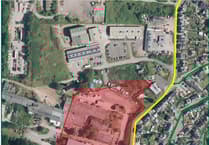


.jpeg?width=209&height=140&crop=209:145,smart&quality=75)
The Review offers a survey of some of the key issues and sites which are subject to controversy. People are, of course, able to examine the plan at local libraries and (for personal use) photocopy relevant maps.
Necessarily, the plan's compilers use a lot of technical jargon. That said, the two textual volumes are consciously written to be easily comprehensible. The colour coding on the maps provides an at-a-glance picture of the story – employment areas in slate blue and housing in red-check.
The headline figures are that the plan proposes some 3,000 new houses on top of those already in the pipeline and employment areas (industrial, commercial, retail etc) to create some 3,000 jobs. Since the plan covers the ten years 2001-2011, these proposed increases are hardly disproportionate for a large district.
On the other hand, much of the new development is concentrated in Lydney and Cinderford – where two major housing developments have significant knock-on implications for infrastructure such as roads and social provision such as schools. As the overview in the "District Wide Policies & Proposals" volume puts it, "the Corporate Plan identifies that Lydney offers the greatest strategic opportunity for development in the district, and that Cinderford has the greatest need for revitalisation."
This volume includes, incidentally, very useful appendices listing all important wildlife sites – 47 SSSIs (sites of special scientific interest) and no less than 214 locally important sites identified by the Gloucestershire Wildlife Trust; 37 regionally important geological sites; and 60 or so scheduled ancient monuments (one third being sections of Offa's Dyke).
The remainder comprise half a dozen pre-historic hillforts; Roman sites at Lydney Park, Tidenham, Woolaston and Blackpool Bridge (puzzingly listed thrice); castle sites at English Bicknor, Lydney Park, Ruardean and St Briavels; half a dozen village crosses; plus the Whitecliffe Furnace, Gunns Mill and Lydney harbour.
Lydney
"72 hectares (180 acres) of land to the east of Lydney will be allocated for a mixed development comprising 1,250 houses to be completed over the Plan period, nine hectares of land for employment use, a neighbourhood centre and primary school accommodation," says the "Settlement Policies & Proposals" volume.
The site in question is all the farmland within the by-pass from the golf course to Highfield Hill. The Federal Mogul factory is allowed space to expand, and the corner at the bottom of Nass Lane is also zoned for employment use – stretching across the bypass over Hurst Farm.
Of the latter, the Plan says, "The Hurst Farm sites lies outside the Lydney bypass, within an existing agricultural landscape made up of high quality agricultural land, and forms part of the open countryside surrounding Lydney. The bypass currently, and over the Plan period, will function to contain the outward residential expansion of Lydney.
"There is a need for a cogent strategic justification therefore to provide for development outside the bypass." Some dispute whether such a case is made out, Gordon Biggart's objection in the 'Representations" volume being recorded as, "Development east of the bypass in Lydney is wrong in principle as it is urban sprawl. The council should do everything possible to prevent this development."
Such previous comments in support of or opposition to particular proposals must, if they wish to repeat them, respond during the "deposit" period up to 15th September. "Representations received outside this period will not have the right to be heard at the subsequent Public Local Inquiry."
The East Lydney scheme involves not only a new spine road from the bypass near Federal Mogul to Highfield Road and new neighbourhood centre at Crump Farm with shops and maybe a pub, but also a new road pattern around the top of Nass Lane to cope with extra traffic.
The top of Hams Road will be blocked off as part of pedestrianisation of Newerne Street. Traffic from Hams Road and Nass Lane will pass below the Catholic church to Albert Street, and from where a Newerne Link Road will run behind the car park and health centre to Forest Road.
The Hill Street/Forest Road junction will also be improved, to be joined by the bypass link road running alongside the Cut. The latter is a county council scheme, but the foregoing will be financed as "planning gain" by the East Lydney developers.
The High Street/Bream Road junction is to be improved next to the Watts garage site zoned for retail development where a Tesco's is planned.
"20 hectares (50 acres) of land to the south of the boating lake will be allocated for open space, leisure and recreational uses," says the Plan. There will be links through to the station, including a proposed Riverside Walk which the Review will be exploring shortly.
Beyond the railway line, land will be filled in (literally so) to extend the Industrial Estate. The old tinplate works estate will extend between the bypass and Mead Lane to the Lydney Park roundabout.
On the town perimeter, two small housing developments have provoked opposition. At the back of Templeway West, Holms Farm is proposed as site for around 20 houses. At Allaston, plans for around 40 hours and four hectares (10 acres) of amenity open space at the back of Primrose Hill School were approved by the council's planning committee in May.
An unresolved issue is the relocation of the golf course following housing development. In response to the English Sports Council's objection that it will "lead to the loss of sports facilities which are strategically important in terms of sports development," the council replies that it "Disagrees with the view that the golf course is strategically important in that there is now a wide choice of courses within and adjoining the district."
•Objections (or supporting representations) may be sent (one form per site) to: Director of Planning and Leisure Services, Forest of Dean District Council, Freepost GL464, GL16 8ZZ.
•Next week: Cinderford, Coleford and the rest of the South Forest.